")
")
Design prototype developed in the VBA Esri ArcGIS 8.3 environment. (Bernardo Rapi, Maurizio Romani - 2005)
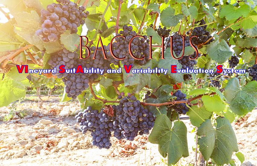
VISAVES is a software package that is based on the typical GIS technology, within which indices, mathematical and statistical models have been implemented, useful for providing elements of understanding the dynamics in progress and supporting decisions in the long, short and medium term.
The methodologies used within the system are continuously studied by the Biofuturo Team and can be transferred to different software environments (.Net, MATLAB, etc.), even for individual modules.
VISAVES objectives
European wine producers need to increase their attention towards the management of the territory and its resources, in an attempt to achieve ever higher levels of rationalization of their activities and optimization of the various production factors.
Having to deal with increasingly competitive markets and facing new challenges from a social and environmental point of view, the availability of advanced tools, able to support the activities of the trustees and decision makers, is felt as a necessity by many operators in the sector.
The system intends to provide a valid response to these needs, giving truly useful information from an operational point of view on the potential of the various vines and on the management of the vineyards according to the environmental peculiarities and specific characteristics of the production reality to which it is addressed. For this reason, the system proposes methodologies and criteria recognized by the scientific community and brought to the operational level thanks to the decisive contribution of local experts and end users.
The integration of Information Tecnology (IT), mathematical and statistical tools with the operators' knowledge and management skills makes it possible to exploit their application potential for the management of productive realities that intend to follow the path of innovation and development.
Since this is a system that needs to be adapted to the characteristics of the production systems that are intended to be supported, the information collection and organization activities, as well as the tuning up of the system, must be thought of as an activity conducted in synergy with the various figures involved.
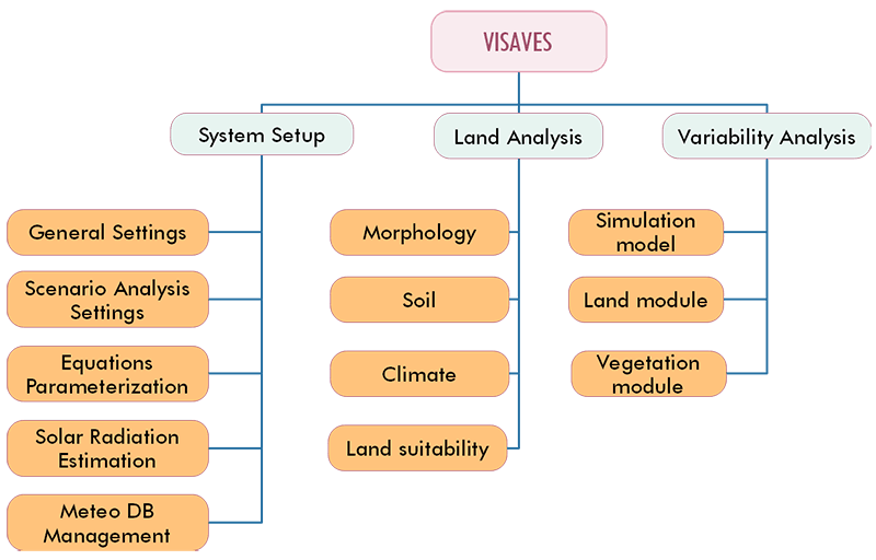
VISAVES functions
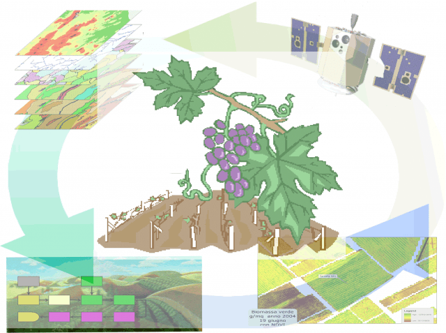
Once the information available for a specific production reality has been organized within its database, VISAVES allows you to perform a series of simulations to evaluate the response of the plant to current conditions and / or to the changes that can be made or that can intervene in that specific production context.
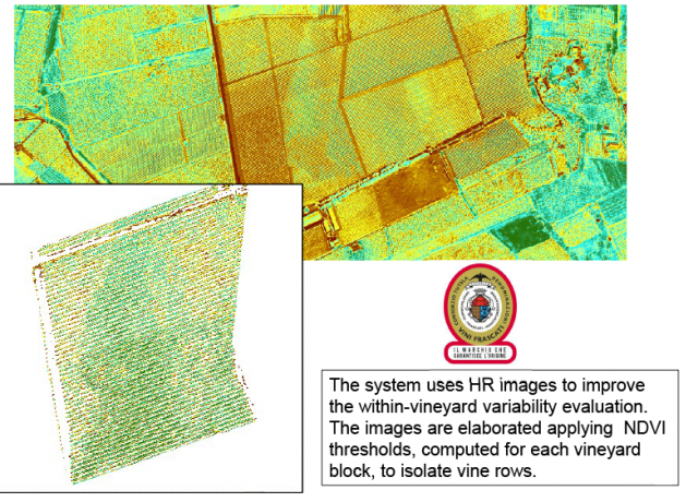
For a better description of the existing condition, the system requires one or more multispectral images, acquired from high-resolution satellites or other aerial platforms (aircraft, UAVs, etc.), during the phase of vegetative development The required / useful resolution varies, depending on the desired applications, from a few meters to a few centimeters.
The various tools allow you to:
Long-term assessments (years)
- Characterize the environment from a morpho-pedo-climatic point of view
- producing maps of:
- Aspect, altitude and slope;
- Solar radiation (on the slope and inside the vineyard);
- Pedological classes;
- agroclimatic indexes (thermal, heliothermic, pluviometric, hydrometric, etc.).
- producing maps of:
- Identify the most suitable areas for a specific cultivar and rootstock, by integrating territorial peculiarities with the needs of plants
- Identify the best exposure of the plants and organize the vineyard
- Estimate the water needs and any additional needs compared to the rainfall characteristics, during the different development phases.
Mid-term evaluations (months)
- Estimate the effect of certain practices on production and quality
- Dry and green pruning;
- Thinning;
- Fertilization;
- grassing
- Predict the effect of harmful events
- Frosts
- Parasitic attacks
- Water stress
- Produrre con mesi di anticipo una forbice produttiva in funzione del possibile andamento climatico fine a fine anno
- optimal
- medium
- negative
- Identification of homogeneous areas by
- Phenological phases
- Biomass
- Production
- Quality
Short-term assessments (days)
- Management framework
- Current system
- Crop surface
- Planting layouts
- Vines
- rootstocks
- Age of plants
- Irrigation system
- agricultural machinery
- Historical archive
- Crop operations
- Yields
- Product quality
- Management program
- Cultural interventions
- Scheduled treatments
- Amministration
- crop interventions forecast
- Current system
- Description of variability inside the vineyard
- Identification of homogeneous zones (attribution of measured values)
- Biomass
- Leaf Area Index
- Health Condition
- Variability index (greater variability = greater management difficulties)
- Identification of areas of low development or with the presence of stress
- Risk assessment of pests and diseases
- Water balance within the different areas of the vineyard
 All the information acquires added value over time, as the historical archive is filled, increasingly reliable statistical evaluations are possible, which allow a better understanding of the production reality of interest.
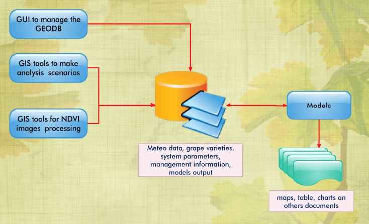
The system database can be put into communication with existing data archives, making it possible to automate some management processes. Furthermore, the integration between archives can favor the updating and exchange of information within the production chain.


